Blog
Portugal’s Seabed Energy Farms Points a New Way for Ocean Nations


Portugal’s Seabed Energy Farms Points a New Way for Ocean Nations
By Ighoyota Onaibre | Waterways News Correspondent
Finland’s AW-Energy and a 14-partner European consortium have deployed WaveRoller technology off Peniche in a milestone that maritime and energy planners from Lagos to Abuja should be watching closely
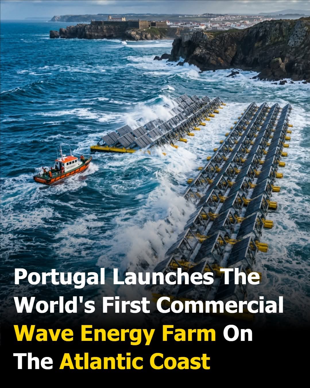
Eight hundred and twenty metres off the coast of Peniche — a windswept fishing town on Portugal’s Atlantic seaboard long known for its big-wave surfing — something quietly extraordinary is happening on the ocean floor. Hinged panels, each the size of a large shipping container standing on end, are anchored to the seabed in 15 to 25 metres of water. As deep Atlantic swells roll in from the open ocean, the panels rock back and forth with the surge. Every tilt and recovery drives hydraulic fluid through onshore generators. The ocean is, in the most literal sense, doing the work.
This is not a laboratory experiment. It is the commercialisation of wave energy — one of the most elusive prizes in renewable power development — and it is happening now.
The Technology: How WaveRoller Works
The device behind the Peniche installation is the WaveRoller, developed by Finnish clean energy company AW-Energy. The first unit of the wave power farm was successfully installed on the seabed, marking the beginning of the commercial phase of clean electricity production.

The principle is elegantly simple. The technology consists of a vertical panel that moves with the sea currents, capturing energy that is transmitted to a hydraulic system and then to a power plant. Unlike offshore wind turbines, which are visible from the shore and exposed to storms, WaveRoller units sit beneath the surface, sheltered from the worst of the weather, anchored to the seabed by a foundation system engineered to handle the relentless pressure of open-ocean swells.
The device is installed 820 metres offshore from Peniche, and during the commissioning phase, operators collect data around the clock to monitor performance using motion, pressure, and strain gauge sensors engineered into its panel, foundation, and bearings. AW-Energy CEO Christopher Ridgewell has said the data received from the installation indicates the WaveRoller is operating well and performing in accordance with expectations.
The connection to the national grid runs via an onshore substation, meaning the power generated beneath the waves travels ashore through a submarine cable and feeds directly into Portugal’s electricity network — the same infrastructure that powers homes, hospitals, and factories.
ONDEP: Scaling Up to Commercial Reality
The latest and most significant chapter in Peniche’s wave energy story is the Ondas de Peniche project, known by its Portuguese acronym ONDEP. The ONDEP project has been awarded €19 million from the EU’s Horizon Europe funding programme to deploy a 2 MW wave energy array featuring four WaveRoller wave energy converters. The project commenced in October 2024 and will last five and a half years, encompassing the full spectrum of project activities — from design and manufacturing to testing, deployment, and operation.
Two megawatts may sound modest in an era of gigawatt-scale offshore wind farms, but the significance of ONDEP lies not in its size but in what it proves. The pilot wave farm will be installed and connected to the grid and will continue generating electricity for an additional eight years after the project’s official end (Energy Global) — a total operational horizon of more than thirteen years that will generate the long-term performance data the industry has long needed to attract serious infrastructure investment.
The ONDEP project will also establish a comprehensive, end-to-end European supply chain to support the deployment of gigawatt-scale wave energy across Europe and beyond, as a significant step towards the industrialisation of wave energy.
Ridgewell has described the project as the culmination of two decades of development work: “This project builds on two decades of hard work developing WaveRoller into a commercial asset. We’re excited to work on this collaboration together with the other partners to create a new industry in Europe.”
Led by Queen’s University Belfast, ONDEP involves 14 partners from Belgium, Finland, France, Italy, the Netherlands, Norway, Portugal, Spain, and the United Kingdom.
The breadth of that consortium — spanning universities, engineering firms, marine contractors, and grid operators — reflects the complexity of bringing an ocean energy technology from prototype to bankable commercial product.
Why Wave Energy Matters: The Case for the Unstoppable Resource
The appeal of wave energy, to engineers and energy planners alike, comes down to one word: predictability. Solar panels produce nothing at night and struggle on cloudy days. Wind turbines are idle when conditions are calm. But wave energy captured through the rhythmic motion of the sea offers one of the most consistent, predictable forms of renewable power on the planet. Unlike solar or wind, waves do not sleep. They do not stall. They do not depend on perfect weather.
This consistency is particularly valuable to grid operators trying to balance supply against demand around the clock. A power source that generates reliably through nights, cloudy seasons, and calm spells fills precisely the gap that intermittent renewables cannot. For coastal nations with energy deficits and long Atlantic-facing coastlines, it is a resource that literally never stops arriving.
The Africa Dimension: A $296 Billion Blue Economy Waiting
For Nigerian maritime and energy policymakers, the Peniche story carries a very direct message. Nigeria boasts an 853-kilometre coastline along the Atlantic Ocean and extensive inland waterways covering over 10,000 kilometres. Data from the Nigerian Maritime Administration and Safety Agency projects the value of Nigeria’s untapped blue economy potential at a stunning $296 billion. (Voice of Nigeria)
Apart from harnessing tidal and wave energy as part of Nigeria’s green transition, marine biotechnology, research and development in marine-based pharmaceuticals and bio-products are opportunities waiting.
Research has already begun to quantify the resource. A study evaluating Brass Creek in Rivers State found that the site is characterised by moderate to high significant wave heights and favourable wave periods, with annual mean wave power density reaching 31.42 kW/m and seasonal peaks observed during summer and autumn. The prevailing wave direction aligns with the Atlantic swell, further supporting the site’s suitability for wave energy extraction. The same study found that significant wave heights above 1.5 metres occur with a probability of 93.6%, underscoring the reliability of the resource.
Yet despite this documented potential, Africa has no commercial wave farms today — not one.
The instantaneous wave power resource of African waters has previously been estimated to be between 324 GW and 422 GW — a figure that dwarfs Nigeria’s current installed electricity generation capacity many times over. Investing in offshore wind, tidal, and wave energy can provide sustainable sources of electricity while reducing greenhouse gas emissions, according to analysts assessing Nigeria’s blue economy prospects.
Nigeria Watch: What the Peniche Milestone Means for Nigeria’s Marine and Energy Sectors
Portugal’s Peniche installation is more than a technology story. It is a policy signal — and Nigerian stakeholders, from the Federal Ministry of Marine and Blue Economy to NIMASA and the Nigerian Electricity Regulatory Commission, should take note of several dimensions.
The regulatory template. Portugal has not simply funded a project; it has built a framework — grid connection standards, seabed lease arrangements, environmental monitoring protocols — that took years to develop. Nigeria’s maritime regulatory architecture, currently being strengthened under the Marine and Blue Economy agenda, will need analogous structures if ocean energy is ever to attract private capital.
The financing model. ONDEP’s €19 million EU Horizon Europe grant was matched by a consortium of fourteen institutional partners. No single government carried the risk. Nigeria’s engagement with multilateral development finance — the African Development Bank, the World Bank’s IFC, and bilateral climate funds — offers a comparable pathway, particularly given Nigeria’s NDC commitments under the Paris Agreement.
The coastal community dimension. One of the stated objectives of the Peniche installation is ensuring that residents of Peniche benefit directly from the energy it generates. Nigeria’s coastal communities — in Bayelsa, Delta, Rivers, Akwa Ibom, Cross River, Lagos, Ogun, and Ondo states — have historically seen their maritime resources extracted without equivalent benefit flowing back. A wave energy programme conceived from the outset around local grid connection and community benefit-sharing would represent a meaningful departure from that pattern.
The port infrastructure opportunity. Eco Wave Power, a separate Israeli-Swedish technology company, is implementing a first 1MW project at a breakwater facility in Porto, Portugal, which is expected to be finalised during 2026. The Porto model — attaching wave energy converters to existing port infrastructure rather than deploying standalone offshore arrays — is directly applicable to Nigeria, where the Nigerian Ports Authority manages breakwater and jetty structures at multiple locations along the coast. NPA’s concession renewal discussions and its ongoing infrastructure modernisation programme would be a natural vehicle for piloting a comparable installation.
The Bottom Line
What Portugal has demonstrated at Peniche is not a proof of concept — that stage passed some years ago. What it has demonstrated is commercial viability at grid scale, backed by serious institutional money, operating under real regulatory conditions, with a business model that works.
For Nigeria, with its vast Atlantic coastline, its chronic electricity deficit, its expanding Federal Ministry of Marine and Blue Economy mandate, and its $296 billion blue economy prize still largely uncaptured, the question is no longer whether wave energy is technically possible. The question is whether the policy will, the institutional coordination, and the financing architecture can be assembled before another decade passes.
Peniche’s seabed is moving. Lagos’s energy planners should be too.
Blog
Sacred Waters Defiled: Child Allegedly Thrown into Ovia River on Native Doctor’s Orders as Edo Community Searches

Sacred Waters Defiled: Child Allegedly Thrown into Ovia River on Native Doctor’s Orders as Edo Community Searches
A five-year-old’s fate hangs on the currents of a revered waterway as Nigeria confronts the deadly intersection of superstition, desperation, and the failure of community safeguards
By Oghenewoke Osaweren | Waterways News
The Ovia River flows through Ovia North-East Local Government Area of Edo State as it has for centuries — a waterway revered in local tradition as a source of life, abundance, and protection. On a day this past week, it allegedly became the site of one of the most disturbing incidents yet reported along its banks: a mother is said to have cast her five-year-old child into its currents, not in a moment of psychological collapse, but in deliberate compliance with the instructions of a so-called seer.
Search parties were immediately mobilised. As of the time of filing this report, residents of the affected community continue to comb the river’s banks and shallows, the sounds of urgent voices carrying across the water in a search that should never have been necessary.
The woman, whose identity has not been officially confirmed by authorities at press time, allegedly told community members who confronted her that she acted on the direct order of a local spiritualist — a “seer” — who reportedly prescribed throwing her child into the river as part of a spiritual ritual. What the woman was promised in return, and what desperation drove her to compliance, remains under investigation. She has since been apprehended by residents and is expected to be handed to the police.
The Edo State Police Command had not issued a formal statement as of press time. Waterways News is actively seeking confirmation from the command’s spokesperson, ASP Eno Ikoedem.
A Waterway With a Name — And a History
The Ovia River is not simply a geographic feature. In Edo cultural and spiritual tradition, Ovia is honoured as a deity of peace and providence — a force held, in oral tradition, to have emerged during times of communal crisis to restore harmony and protect the people from harm. Shrines were raised in Ovia’s name. Songs were composed in her honour. Communities settled along this waterway precisely because of what its waters were believed to offer: safety, sustenance, and continuity.
That a child was allegedly cast into those same waters — not in any ancient ceremonial context, but on the profit-driven instruction of an individual exploiting a vulnerable woman’s faith — is a desecration that cuts across both the human and the spiritual dimensions of this story. The river that communities built their lives around has allegedly been turned against one of its most defenceless members.
This incident adds to a grim record accumulating along the Ovia River corridor. Just weeks prior, the Edo State Police Command recovered the bodies of two women abducted from Iyowa Community within the same Ovia North-East LGA — their remains found in a forest grave after a member of the kidnapping syndicate led operatives to the site. A community that has barely processed one wave of grief now faces another.
The Scale of the Crisis
If confirmed, this incident will not be an anomaly in the national record. It will be the latest entry in a documented and growing pattern.
Data from the National Bureau of Statistics, cited by the National Agency for the Prohibition of Trafficking in Persons (NAPTIP), recorded over 150 ritual killings across Nigeria in the first half of 2025 alone, with women and children as the primary victims. The National Institute for Legislative and Democratic Studies documented over 168 ritual-related deaths in 2022, and nearly 100 in 2024.
NAPTIP leadership has publicly characterised the phenomenon as symptomatic of deeper structural failures. These are not random acts, the agency has stated — they are the product of poverty, inequality, weakened community values, and widespread belief in the efficacy of ritual harm as a route to personal advancement or protection. Weak law enforcement and slow judicial processes have compounded the problem by emboldening perpetrators.
The “seer” in the Ovia case — whoever they are — remains at large.
NIGERIA WATCH | When Waterways Bear Witness to Governance Failure
Let’s situate this story within the wider framework of Nigeria’s inland waterway governance, community protection obligations, and the state’s relationship with its river communities.
Rivers occupy a paradoxical position in Nigerian public life. As physical infrastructure, they are chronically underinvested — the National Inland Waterways Authority (NIWA) has for years contended with inadequate funding, unregulated jetties, and persistent safety gaps along major inland routes. As cultural and community anchors, they are simultaneously some of the most socially significant spaces in the country, carrying the weight of tradition, livelihood, and collective identity.
Yet neither dimension — the infrastructural nor the cultural — is adequately protected by the Nigerian state.
The alleged incident on the Ovia River exposes a governance gap that runs deeper than policing. Inland river communities across Nigeria exist in a condition of compound vulnerability: physically isolated from emergency services, socially embedded in belief systems that formal institutions rarely engage with seriously, and economically marginalised in ways that make desperate choices more likely. The woman at the centre of this story did not arrive at this moment in isolation. She arrived there through a series of compounding failures — of social support systems, of community mental health infrastructure, of any credible state presence capable of disrupting the charlatans who operate freely in spaces where formal authority is absent.
The “seer” economy — the network of native doctors, spiritualists, and ritual practitioners who prey upon vulnerable individuals in communities across southern Nigeria — thrives precisely in the governance vacuum that the Nigerian state has not filled. It fills the space where functional healthcare, social welfare, legal recourse, and psychological support should exist. Where the state is absent, the charlatan moves in.
NIWA’s mandate, and the broader Federal Ministry of Marine and Blue Economy’s remit, technically encompasses the development and protection of Nigeria’s inland waterway communities — not only their economic function, but the communities that depend on them. In practice, that mandate has rarely extended to meaningful community protection frameworks. There are no early warning systems for at-risk households along inland waterway corridors. There are no integrated social intervention programmes tied to waterway community development plans. The rivers are managed, where they are managed at all, as transport corridors — not as living community spaces requiring holistic governance.
Three immediate actions are now required. First: full deployment of search and rescue capacity on the Ovia River, with federal and state coordination if local resources are insufficient. NIWA maintains operational presence along major inland waterways and its assets should be made available to support this effort.
Second: the arrest and prosecution of the seer who allegedly issued the instruction that placed a child’s life in danger. Nigerian law on conspiracy and incitement is applicable, and the individual who gave the order bears criminal responsibility equal to — if not greater than — that of the person who carried it out.
Third: a policy conversation, long overdue, on the integration of social protection frameworks into Nigeria’s inland waterway community governance architecture. The Ovia River corridor, like dozens of others across the Niger Delta and south-south region, cannot be treated as a transport asset while the communities along its banks remain invisible to the welfare state.
A child was allegedly thrown into a Nigerian river on the word of a man who walked away. The river did not ask for this. The community did not deserve this. And the state, which governs neither the waterway nor the community adequately, cannot continue to treat each such incident as an isolated outrage and then move on. Nigeria’s inland waterways connect communities. They also, in moments like this, reveal exactly how unprotected those communities are.
Waterways News will continue to follow this story as official police statements and further community reports become available. Key facts — including the identity of the woman, the identity of the seer, and the status of the child — remain unconfirmed pending official police response. This report presents what is known while framing the verified wider context of superstition-driven harm in Nigerian inland waterway communities.
Blog
U.S. Marks National Maritime Day with Federal Ceremonies, Port Events, and Historic Naval Review
U.S. Marks National Maritime Day with Federal Ceremonies, Port Events, and Historic Naval Review
As America turns 250, the annual observance takes on special significance with tall ships, international fleets, and a sweeping celebration of maritime heritage
By Oghenewoke Osaweren | Waterway News Correspondent | May 22, 2026
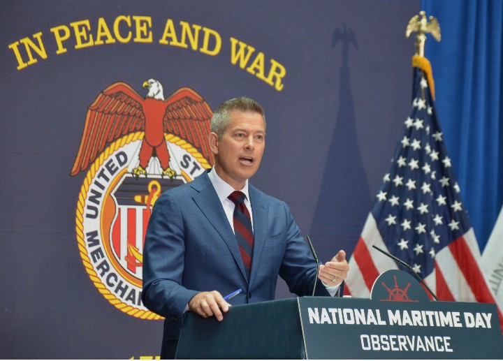
The United States on Friday observed its annual National Maritime Day, honouring the nation’s Merchant Marine, the civilian mariners who have powered American commerce and supported its military since the republic’s founding — an occasion that this year carries extraordinary weight as the country simultaneously marks its 250th anniversary.
Held every year on May 22, the observance is not a federal public holiday — government offices and businesses remain open — but it draws significant participation from federal agencies, port authorities, industry associations, and maritime communities across the country.
Federal Government Leads Official Proceedings
The Maritime Administration (MARAD), the federal body that oversees U.S. maritime policy and the Merchant Marine, opened the day with its official National Maritime Day Celebration, the flagship federal event anchoring the observance.
Later in the evening, the Propeller Club of Washington, D.C. hosted a reception at the Hart Senate Office Building, beginning at 5:30 PM. The event brought together maritime industry professionals, lawmakers, and stakeholders to recognise contributions to U.S. maritime heritage and sustain dialogue between the industry and the legislative community.
Separately, the North American Marine Environment Protection Association (NAMEPA) convened its annual Safety at Sea Seminar, where attention centred on maritime safety protocols, search-and-rescue operations at sea, and the protection of the marine environment. The event also featured the prestigious AMVER/Benkert Awards, which recognise outstanding contributions to saving lives at sea.
Galveston Opens Its Ports to the Public
On the Gulf Coast, the Port of Galveston, Texas, staged a free public event at Cruise Terminal 16 between 8:30 AM and 11:30 AM local time. Residents and visitors were welcomed aboard vessel tours and maritime exhibition booths, while a formal commemoration ceremony — complete with a colour guard, wreath-laying, and addresses from invited speakers — marked the gravity of the occasion.
Port public events of this kind have become a defining feature of National Maritime Day, connecting ordinary citizens with an industry that underpins much of what arrives on American shelves and shores.
Sail250 and the International Naval Review Signal a Grander Stage
The most expansive maritime spectacle tied to this year’s observance, however, stretches well beyond a single day.
Sail250, mounted as part of America’s 250th anniversary commemorations, will see more than 60 ships from 20 nations tour American ports from May 28 through July 16, 2026. The international flotilla will make port calls in New Orleans, Norfolk, Baltimore, New York City, and Boston, in what maritime observers are describing as one of the largest international naval reviews on American soil in decades.
The grand finale is set for July 4, 2026, when New York Harbour will host a sweeping maritime spectacle — tall ships, naval vessels, and aerial displays converging on the water to mark two and a half centuries of American independence.
The Merchant Marine: A Legacy of Commerce and Sacrifice
National Maritime Day traces its roots to the vital but often overlooked role of the U.S. Merchant Marine — the fleet of civilian-crewed commercial vessels that has carried American trade across oceans and, in times of war, supplied allied forces with munitions, fuel, food, and troops.
Merchant mariners served at enormous personal risk during both World Wars, and the industry’s collaboration with the United States military has remained a cornerstone of national security planning ever since. Today, the observance serves as a formal acknowledgement of those contributions — to the economy, to national defence, and to the global shipping lanes on which modern trade depends.
Significance for the Global Maritime Community
For maritime nations watching from across the Atlantic and beyond — including Nigeria, where the inland waterway and coastal shipping sectors continue to attract policy attention and investment — the American observance offers a model for institutionalising maritime heritage and building public awareness of the sector’s economic centrality.
A Call for Nigeria’s National Maritime Day
Nigeria’s own maritime regulator, the Nigerian Maritime Administration and Safety Agency (NIMASA), has in recent years pursued initiatives to elevate the profile of maritime commerce domestically. Industry voices have long called for a comparable national moment of recognition for Nigerian seafarers, port workers, and inland waterway operators.
As the United States celebrates its maritime legacy this week, those conversations take on fresh relevance closer to home.
Waterway News | Nigeria’s Leading Voice on Maritime and Inland Waterway Affairs
www.waterwaynews.ng
Understanding the Nautical Mile: The Mariner’s Unit of Distance
From ancient celestial charts to modern GPS systems, one unit of measurement has remained constant across the seas — and every seafarer must know it.
By Raymond Gold | Waterways News Editorial Desk | Maritime Education
In the world of maritime navigation, precision is not a luxury — it is a matter of life and safety at sea. Whether you are a deck officer plotting a course across the Atlantic, a pilot officer filing a flight plan, or a maritime cadet sitting your first professional examination, there is one fundamental unit of measurement that underpins everything: the nautical mile.
Yet despite its centrality to all things marine and aviation, the nautical mile remains poorly understood by many outside the profession. What exactly is it? Why does it differ from the ordinary mile we use on land? And why has it remained the global standard for over a century? Waterways News answers these questions in full.
“The nautical mile is not an arbitrary unit — it is carved from the very geometry of the Earth itself.”
What exactly is a nautical mile?
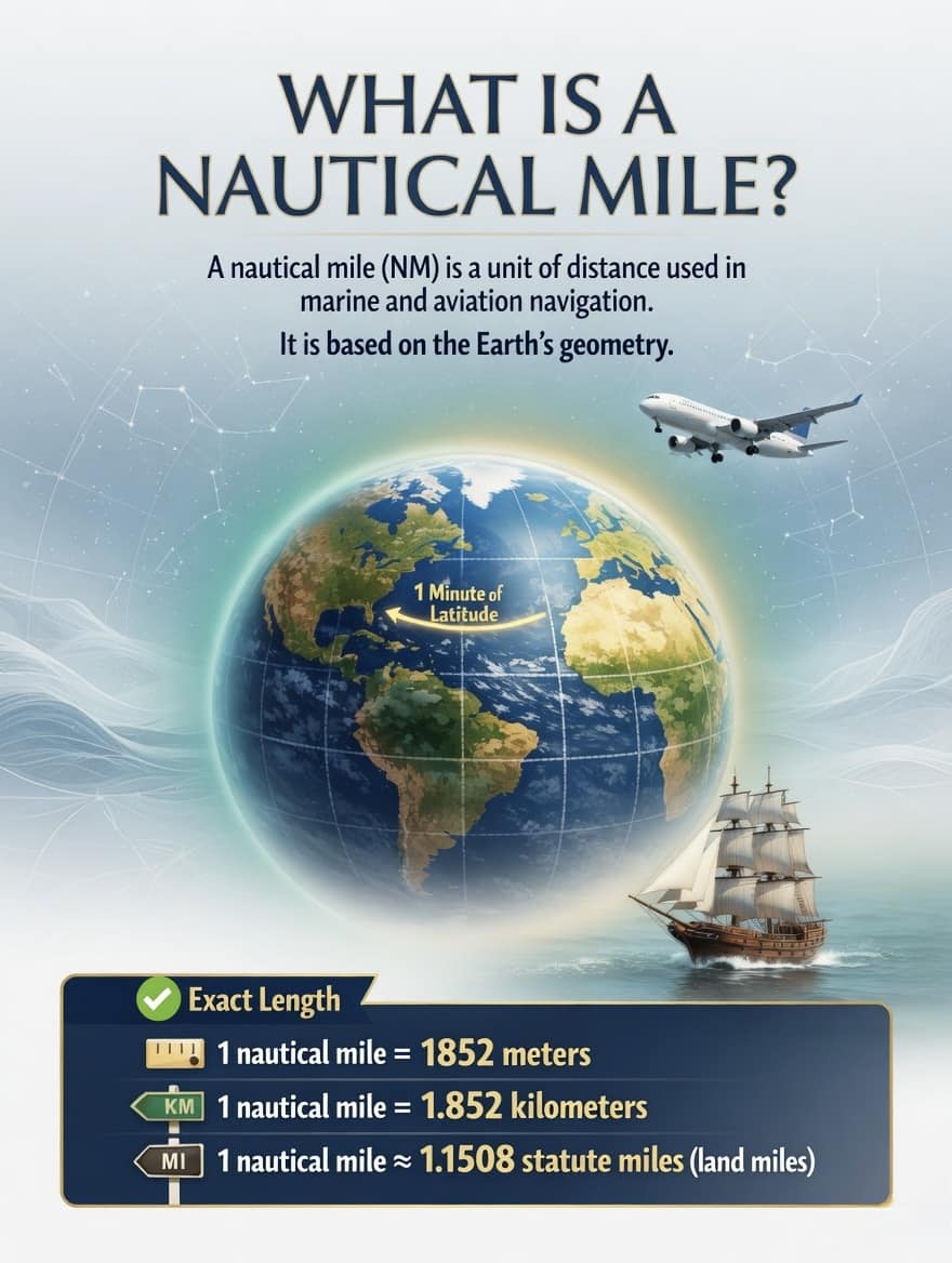
A nautical mile (abbreviated as NM or nm) is the standard unit of distance used in both marine and aviation navigation worldwide. Unlike the statute mile — the familiar unit of distance used on land in countries such as Nigeria, the United Kingdom, and the United States — the nautical mile is not derived from historical convention or old imperial standards. Its definition is rooted directly in the geometry of the Earth.
Specifically, one nautical mile is defined as exactly one minute of arc of latitude on the Earth’s surface. The Earth is divided into 360 degrees of latitude, and each degree is divided into 60 minutes. That means the circumference of the Earth is essentially 360 × 60 = 21,600 nautical miles — a fact that makes the nautical mile extraordinarily useful for navigators, since a degree of latitude on a nautical chart corresponds directly to 60 nautical miles, and one minute of latitude to one nautical mile.
KEY CONVERSIONS — 1 NAUTICAL MILE EQUALS
In metres 1,852 metres exactly
In kilometres 1.852 km
In statute miles ≈ 1.1508 land miles
In feet ≈ 6,076 feet
Why not just use kilometres or land miles?
The question is a fair one, particularly for students approaching maritime education for the first time. The answer lies in the relationship between the nautical mile and the Earth’s coordinate system. Because navigators work with latitude and longitude — a system based on degrees and minutes — the nautical mile offers an immediate and intuitive connection between a chart reading and a real distance.
If a navigator notes that two positions differ by 30 minutes of latitude, they instantly know the distance between them is 30 nautical miles. No conversion is necessary. Using kilometres or statute miles on a nautical chart would break this elegant relationship and introduce unnecessary opportunity for error — a dangerous outcome at sea.
This consistency holds true anywhere on the globe: the relationship between one minute of latitude and one nautical mile does not vary whether you are navigating the Niger Delta waterways, the Gulf of Guinea, the English Channel, or the South China Sea. That universality is precisely why the nautical mile has been adopted as the international standard by bodies including the International Maritime Organization (IMO) and the International Civil Aviation Organization (ICAO).
Speed at sea: the knot
At sea, speed is not measured in kilometres per hour or miles per hour — it is measured in knots. One knot is defined as exactly one nautical mile per hour. A vessel travelling at 12 knots covers 12 nautical miles every hour. This unit, too, has a history tied directly to maritime practice — early sailors measured speed by throwing a wooden float overboard and counting how many knots on a rope passed through their hands in a fixed time.
The short answer: anyone involved in maritime or aviation operations. Deck officers and marine pilots use nautical miles daily for course plotting, passage planning, and position reporting. Port and harbour authorities reference distances in nautical miles when coordinating vessel traffic. Search and rescue coordinators define search areas in nautical miles. Meteorologists and oceanographers use nautical miles and knots when describing weather systems affecting coastal and offshore waters.
For Nigeria specifically — a country with an extensive coastline along the Gulf of Guinea, a vast network of inland waterways including the Niger and Benue river systems, and a growing oil and gas maritime sector — the nautical mile is foundational knowledge for anyone working in or around the nation’s blue economy. From NIMASA-licensed officers to small-craft operators on the Lagos Lagoon, from river pilots on the Niger to offshore supply vessel crews, understanding this basic unit is the starting point for all professional maritime competence.
A note for maritime students
If you are currently studying for a professional maritime certificate of competency — whether at the Nigerian Maritime University, the Maritime Academy of Nigeria in Oron, or any other approved institution — expect the nautical mile and its conversions to appear in your navigation and chartwork papers. Memorise the key figures: 1 NM = 1,852 metres. Know that one degree of latitude = 60 nautical miles. And understand that speed at sea is always expressed in knots, never kilometres per hour.
These are not merely examination facts. They are the language of the sea — and knowing them fluently is the mark of a professional mariner.
Chief Raymond Gold is Co-Publisher and Research Reporter at Waterways News

 Oil and Gas7 months ago
Tantita’s Pipeline Deal: $144m Contract, Rising Output, and the Questions that Deserve Answers
- MARITIME TRADE & SHIPPING7 months ago
World’s Largest Container Ship Sets New Maritime Record with 22,233 TEUs on Single Voyage
- Blue Economy7 months ago
Nigeria’s Coast Guard Bill: A Solution in Search of a Problem?